|
|
|
San Francisco Event Plans: Race Areas and Piers 27-29 January 20, 2011 |
|
Overall
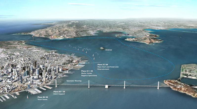
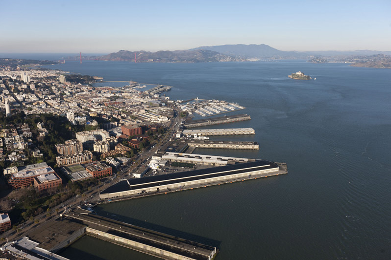
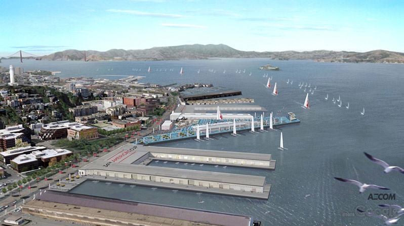
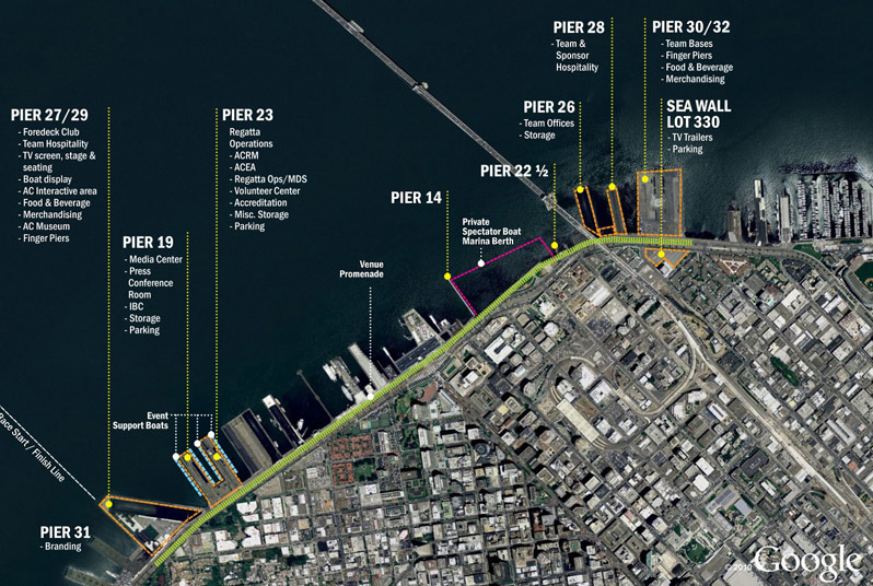
Northern Water Front Plan The event plan immediately above is from exhibits accompanying the Host City Agreement drafted by the City of San Francisco and Golden Gate YC. It is a preliminary outline for the Northern Waterfront Alternative which replaced the original plan that centered the America's Cup Village on the piers south of the Bay Bridge. While the renderings on this page are useful as a starting point in understanding the scope and locations for the improvements intended for the America's Cup Village when Golden Gate YC defends the America's Cup in 2013. Some of the specifics may change as more serious design takes place now that GGYC's selection of San Francisco is official, and the approvals, entitlements, and detailed feasibility studies progress. North is to the left, the top of the image is roughly east. Downtown San Francisco is to the lower middle-right of the image, the Bay Bridge is at the top of the image which is roughly east. AT&T Park, the baseball stadium of the San Francisco Giants, is at the far right along the waterfront. The majority of public activities would take place on Piers 27/29, which hosts attractions and entertainment, and on Piers 30/32 where the teams would be based. A Promenade, the winding green line along the Embarcadero in the image above, would connect the various locations. Further south would be facilities to support
USA 17, BMW Oracle's America's Cup-winning trimaran, with
mooring space adjacent, which implied that the incredible boat might
sail again, this time in San Francisco Bay, though the team has
since said they have no plans to do so. |